Showing posts with label Hobart. Show all posts

March 2026 - Clarence Foreshore Trail

Thanks to Wayne for organising this walk, and writing its story. The March walk was originally planned for Cape Queen Elizabeth on Bruny Island. Unfortunately the weather forecast was not great for Bruny Island, plus a few people couldn't make it due to other plans the day before or the day after the proposed walk. It was then determined to move the walk much closer to suburbia, so we settled on the Clarence Foreshore Trail from Howrah Beach to the Bellerive waterfront, partaking of lunch in Bellerive and meandering back to the starting point on Howrah Road.

The starters from Howrah Road were Catherine, Peter, Bob, Angie, Summa, Gerwyn & Wayne. A few of us met Angie at Atmosfire Cafe, Howrah, for a drink before the walk.
Along the track we passed the Howrah Primary School, where a few students were partaking in physical exercise, probably more energetically than us. At the Wentworth Bike Park & Play Park there were some parents and children enjoying a pleasant Friday morning.

We walked around the headland towards Bellerive Beach, and the headland is where we met Gary, who joined us there for part of the walk.
Coming down from the headland, we walked along Bellerive Beach toward Ninja Stadium, then walked around Victoria Esplanade to the Bellerive waterfront. Here we lost Gary, who had organised to have lunch at the Waterfront Hotel.
We checked out the boardwalk, then headed through the backstreets to find The Fish Bar at Bellerive Beach for a feed of fish & chips.

After lunch we headed back along the walking trail inside the dunes from the beach to provide a bit of variety in the walk. It was on this part of the walk that we saw a southern brown bandicoot, which is fairly common in this area. Unfortunately it was quite shy and didn't want to pose for a photo.
We continued back along the Foreshore Trail back to Howrah Road, said our goodbyes and went on our merry ways. All in all, a pleasant 3 hour walk (including lunch), not too strenuous and fine weather.

February 2026 - St Crispin's Well, Pipeline Track

Nine of us presented for our February walk, which would be a relatively easy stroll along the gently inclining Pipeline Track to find St Crispin's Well, and then a simple return along the (now) slighty declining track. Di, Bob, Wayne, Gerwyn, Summa, Janet, Angie, Heather, and Fin arrived at the carpark near the turnoff to Morphetts Rd at 9.30am. It was Heather's first walk with our group (hi Heather), and our leader today was Di. The day was warm but not hot, perfect for a walk.
There was a short steep section up a fire trail to reach the Pipeline Track, then we turned left and enjoyed the pleasant (almost flat) gravel path which runs alongside or on top of the historic water pipeline which has carried water down from the back of the mountain towards the city since the early days of the colony. ...
When we got to the all weather shelter and the turnoff up the hill to St Crispin's Well, we were a bit confused by the signage. We pushed around the barrier, determined to see the Well since we had walked all this way. The path up the hill is very pretty.
It wasn't long before we reached the small lookout platform. It had taken about an hour and a half to walk to here.

Here we saw that there had been some damage, with parts of the decking out of place. So we carefully avoided the gaps while we had our drinks and snacks. The Well is still working well.
We didn't stay long here, as the cool breeze generated in the glade by the falling ice cold water was quite chilling, despite the warm day. We headed back down to the main Pipeline Track again, and headed back down the hill. In about an hour we were back at the turnoff from the track down towards Huon Rd. Those of us at the head of the pack waited for the others to catch up. It had taken about an hour to walk back. So total time taken was about three hours.

Wayne entertained us with some Captain Matchbox Whoopee Band songs after we suggested he might have ants in his pants from sitting on an ants' nest.
We regained our cars, and drove back along Huon Road to the Ferntree Tavern, where we enjoyed a nice counter meal, before heading back home.

July 2025 - Knocksofty Track on Knocklofty

Fin organised this little jaunt on Knocklofty hill which is a familiar green presence for Hobart residents, providing a buffer between the city and kunanyi/Mt Wellington. Some new trails have recently been completed by the Council, connecting Knocklofty to kunanyi. We wanted to check out the new Knocksofty Track and also to make some sense of the maps that had been published. So on another lovely sunny but cool winter's day we gathered at the first picnic table near the carpark at the top of Forest Road. We were twelve: Fin, Lyn, Angie, Wayne, Gerwyn, Janet, Philip, Maryanne (and Bronte), Bob, Di, Peter and Catherine. For the first part of the walk we also enjoyed the company of new friend Annie who is an avid bird photographer.
We avoided the more challenging heights of Knocklofty summit by making a circle around the lower regions. First we meandered along the Sandy Spit track, and then moved up a little along the Mt Stuart Track which overlooks, you guessed it, the suburb of Mt Stuart, and which heads towards the Mt Stuart Lookout.
This is a very pleasant trail through open bushland, with occasional wallabies to be seen (Bronte got quite excited). Then we turned around the hill onto Woodman's Track. At the intersection with the North Slope Fire Trail we identified the connection to the new Knocksofty track. [We didn't find the signage very helpful].
Following our noses a bit, we found the junction of Knocksofty Track, designed as a gradual uphill climb for MTBs, and Yellow Hippo Track, designed as a fast downhill track for MTBs.
We took the Knocksofty Track on the left, and found it a long and steady (extreme zig zag) walk down the hill.
Bike riders were enjoying the tracks too, we passed quite a few rolling slowly up the zig zags or steaming along the downhills. Still following our noses through some intersections with fire trails, we found a large open area at Noah's Saddle, perfect for a lunch stop. This distance of about 5.5km had taken us about two hours.
Gerwyn, Fin and Angie came upon some industrial history, a sawpit, just near Noah's Saddle:
The new trail continues from here to complete the connection into Wellington Park, but we were happy to turn around and return along the same track. To shorten the trip back, we turned right at the Forest Road Fire Trail, which runs along the west flank of Knocklofty, skirting the McRobies Gully tip. This trail was another new experience for us and it was interesting to see the tip from a new perspective.
It was also quick, as we found it only took about an hour to get back to the top of Forest Road and the carpark. So this walk, including lunch and debates about directions, took us a total of about 3.5 hours.

May 2025 - Tinderbox Hills

The last Friday in May was a cold but lovely sunny day for our walk in the Tinderbox Hills, organised by Angie. The walk passes through two privately managed reserves: The Thinking Frog Reserve and the Tasmanian Land Conservancy’s Tinderbox Hills Reserve.

The Tinderbox Hills track from Estuary Drive to Mt Louis Road is about 5 kilometres, plus the extra bit to the top of Mt Louis. There are several hills, with Mount Louis not actually being the highest!

We met up at the turning circle at the end of Estuary Drive, Blackmans Bay, ready to set off around 10am. The crew comprised Angie, Di, Angie’s friend Lee, Warren, Caroline, Bob, Wayne, Gerwyn, Janet, Di and Dorothy. The Tinderbox Hills track starts out as a narrow trail between private house blocks, but soon connects to an easy-going fire trail through land managed by Kingborough Council.
The yellow dotted line here is our route, with an extension at the end to climb Mount Louis:
Although the track itself is wide, there are quite a few steep sections so those of us with walking poles made good use of them.
After about 45 minutes we stopped just before the entrance to the Thinking Frog Reserve for snacks and to admire the view across the Derwent Estuary to South Arm, the Iron Pot, Betsey Island and beyond. We listened out for bird calls and tried (mostly unsuccessfully) to identify them. The Tinderbox Hills are best known as an important habitat for Forty Spotted Pardalotes and Swift Parrots.
Thinking Frog is a privately owned reserve which is protected by a Conservation Covenant under the Nature Conservation Act.
The track took us through this lovely little private reserve, including past a small pond. The water level was very low, and I wondered how the frogs were coping. A further 15 minutes walking brought us to the entrance to the TLC’s Tinderbox Hills Reserve.
There is another nice spot to stop and enjoy the peaceful bush at the top of the next hill, where a stone cairn has been built.
The track then follows the boundary with the adjacent Parks and Wildlife Service Tinderbox Hills Reserve and continues down to the Mt Louis Road entrance. Most folk stopped for lunch around 11.50am at the Mt Louis Road entrance, as there are some large logs to sit on there. Di and Dorothy continued along the Mt Louis Road and found the start of the short but very steep track to the top of Mt Louis. The rest of us caught them up after lunch.
On the top we explored the remains of the Mt Louis Signal Station. I’ve since found out it was built by convicts for Governor Sorell in the 1820s.
And then we retraced our steps along the track, some of us noticing features and other paths we hadn't noticed on the way through (too busy talking!).
We got back to the cars at Estuary Drive just before 3pm. The total distance we walked was 10.8km, taking about 5 hours with our stops for snacks, lunch and explorations. This is a lovely escape from the city, yet so close!

September 2024 - Risdon Dam

Plans are meant to be changed, right? Our first plan was to walk to Fort Direction, always a pleasant walk. Our number was greatly dimished by many of us being unavailable due to work or travelling. And as the date approached, random injuries and illnesses picked more of us off one by one. Till on the day we were down to two - Di and Maryanne - and Di wasn't a hundred percent either. So we opted for a closer walk, hopefully with some protection from the September winds which were still harassing us! We drove to Risdon Dam, and had a pleasant walk around the dam.
Of course we had plenty to talk about, including reporting some wind damage to TasWater (as we're useful citizens). At the end we discovered a sweet new selfie installation - you can see that it's still windy!
We adjourned for an early lunch at Whisk in Lenah Valley. Short and sweet, and we're feeling good.

August 2024 - Bellerive Bluff

The weather was looking pretty bad for our planned walk on the Charles Darwin trail on the Eastern Shore, so most walkers decided that discretion was the better part of valour. Four walkers turned up, determined to get out of the house after days of bad weather: Lyn, Di, Caroline and Maryanne (with four legged friend Bronte).

We met at 9.30 in the carpark at the end of Cambridge Drive, Bellerive shopping centre. The weather seemed to be clearing, just in time, and we set off in good spirits. We agreed that the whole Charles Darwin Trail was off the agenda, but we could go anti-clockwise and enjoy some of the Clarence Foreshore Trail till the weather got the better of us.
There were quite a few walkers on the shared path, rugged up against the cold wind and the threatening showers. We even passed a group doing strength training on the path, creatively using the fence to test their muscles against.

It was a pleasant walk untili we reached Bellerive Bluff. Turning around, we could see the next set of black clouds rolling towards us, so we started briskly walking back again. The rain just caught us before we reached our coffee stop at the cafe at Bellerive Oval. But by the time we'd finished our coffee, and still chatting, the skies were blue again :) . We got back to Cambridge Rd within 2 hours of setting out.

It was good to get out and blow the cobwebs away. Thanks to Lyn for encouraging us do it!

May 2024 - Tangara Trail and Gorringes Beach

This month we were supposed to be gathering at Cradle Mountain for a winter getaway, possibly featuring snow. But our walker numbers declined due to unforeseen events and on top of this the weather was looking dreadful (lots of rain), so our organiser Caroline suggested rescheduling this trip to next year. Agreed!

So that we could still enjoy a walk, Caroline offered us an easy loop along the Tangara Trail in Sandford. This was a new walk for many of us, so we were keen. Nine of us - Caroline, Warren, Bob, Lyn, Di, Maryanne, Wayne, Gerwyn and Gary - gathered at the carpark of the Foreshore Tavern in Lauderdale to confirm directions and carpool. We set off to our walk's starting point at the Mortimer Bay carparking area on Gellibrand Road, Sandford.
It was a pleasant day for it, the weather cool but dry, as we struck off along the Tangara Trail. We were passed by a friendly horse rider early on, also enjoying the trail which can be shared by walkers, bike riders and horses. There are lots of trail turnoff options along the way, so we were carefully watching our map. The trail condition was good, dry and firm.

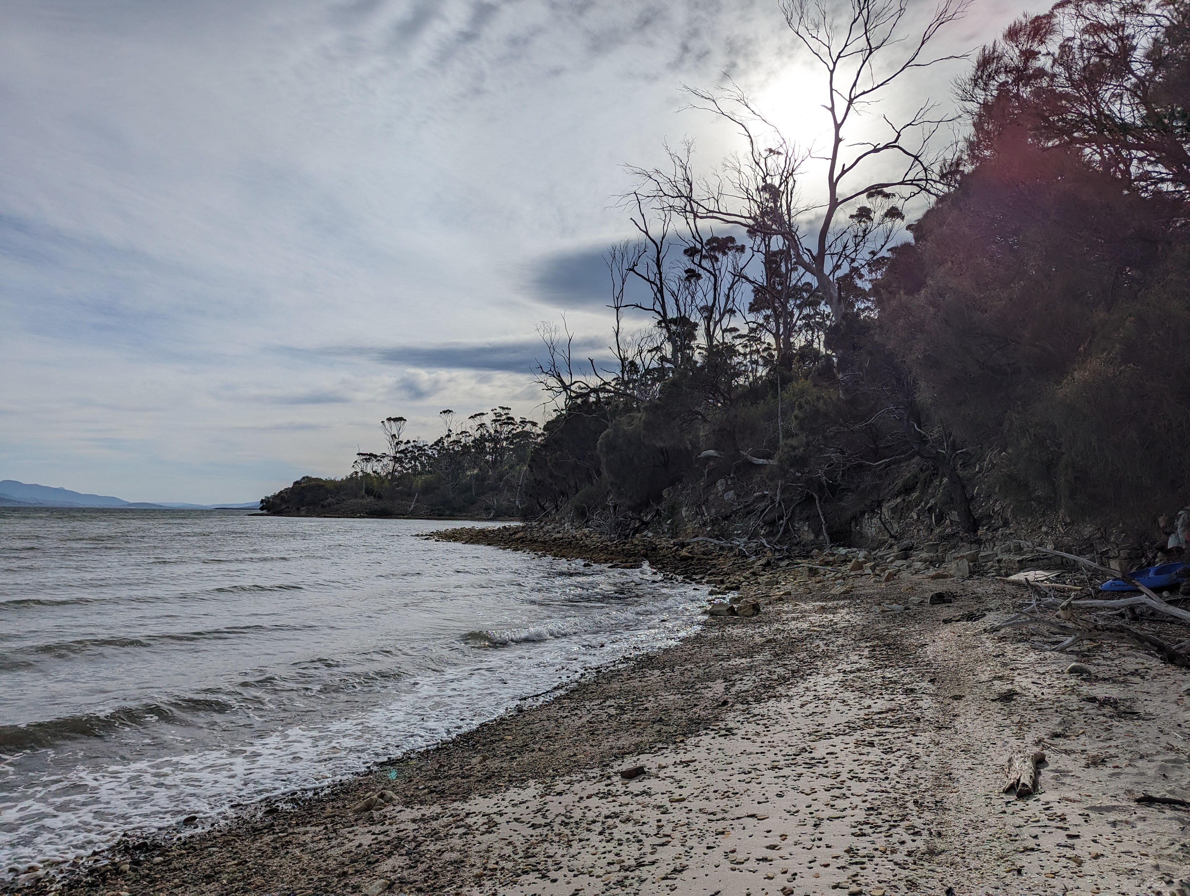
The first section was through dry bushland, running along the back fences of a number of "lifestyle blocks" featuring horses and dogs. After crossing back across Gellibrand Drive we dropped down to the foreshore and down some steps to a secluded little beach, looking across the bay to the South Arm Peninsula.
Looking beyond South Arm we had a lovely view of kunanyi.
The second half of our walk was definitely the more scenic part, as we wandered along the coastal trail, through sheoak woodlands and other native shrubs such as native hopbush and musk. There was evidence of the drought in places, sadly. But we thoroughly enjoyed the glimpses of the Derwent, and our conversations continued all the way.
Bob spotted a nice little seat for a welcome rest. It turned out to be a cute little home made stile for one of the cottages.
It wasn't long before we found ourselves back at Mortimer Bay, a waterbird sanctuary. Actually we didn't see a great deal of Gorringes Beach on this day, but a walk along the beach would be a nice addition one day.
The 6.8km walk had taken us a little over two hours, at our easy pace. Caroline phoned ahead to make a booking at Driftwood on the Lauderdale Canal, and we drove there to enjoy coffee and snacks to complete our day out, walking and talking with good friends.