2 December 2012 - Bishop and Clerk, Maria Island

Three of us, Robert, me and my old school friend Penny, set off from Hobart at 8am to catch the 9.30am ferry from Triabunna.  We were aiming to go up Bishop and Clerk, have a good look around Darlington and, with luck, fit in a quick walk towards the Painted Cliffs before catching the last ferry of the day back, at 4.30pm. It was a lovely early summer day, hot but not blistering, breezy but not too blustery, just right!

Trip planning:  The drive up is about 75 minutes for locals, but would be 90 minutes for visitors not familiar with the roads.  The summer timetable started on 1 December, it allows more trips per day, and more hours on the island for daytrippers.  The fare is $35 per adult, plus GST.  Book tickets by phone, using credit card for payment.

John and Anne, the ferry operators, were very friendly and chatty, quite willing to answer piles of questions from visitors.  An ark population of Tassie devils has recently been deposited on Maria, and one of our fellow passengers was a tracker, going over to locate where they have dispersed to, courtesy of their radio collars.  Filmmakers were making a documentary of scientific work on Maria while we were there, and captured us getting on and off the ferry, so we might be stars soon!


We registered at the Commissariat and ambled around Cape Boullanger, checking out the cemetery and the Miller's cottage, past the old limestone quarry, then the Fossil Cliffs.  En route we saw Cape Barren Geese, Welcome Swallows and Tree Martins. After the Fossil Cliffs you can turn off to the right to return to Darlington, we headed on up Skipping Ridge, above the high and rugged sandstone cliffs.  You would want to hold on to children here, and not do this walk on a very windy day!


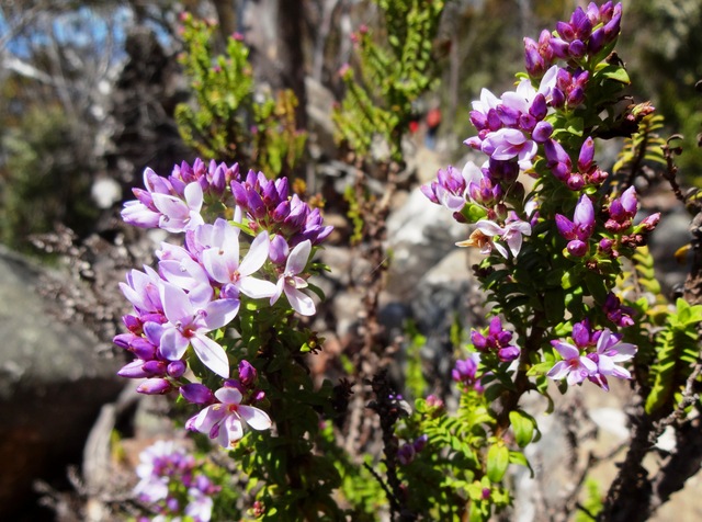
The walk along Skipping Ridge, through the sheoaks, stringybarks and viminalis forest, is lovely, a long  steady gentle climb. Bikes can be ridden along this wide, even track.  You can hire them from the ferry operators or take your own over. We saw more birds, including Green Rosella, Swift Parrot, New Holland Honeyeater, Australian Magpie, Forest Raven, and heard Yellow Wattlebird and Kookaburra.


We were peeling our eyes and ears for the Forty Spotted Pardalote, but couldn't identify it amongst the many birdsongs, despite Robert's Birds of Tasmania app.  It would be great to settle down in a clearing here and just focus on the birds for a while.  A sign appeared, indicating that bikes should go no further, and here a steeper section began, going alternately upwards and level again.

Then we reached the scree slope - this is an extensive and quite steep moraine, fortunately with a well made zig zag track of smaller stones and solid steps at the corners to make the going a bit easier.  Note - a very sensible idea would be to leave your pack at the bottom of the scree and just take water with you from here. This scree section was hard work - I was stopping at each zig to catch my breath, and so made very slow going.  We didn't realise till later that this section is actually right up amongst the dolerite columns, within the Bishop's hat.  The views were already amazing. 

The track notes talk about a small sheltered area near the top to take a break - we had trouble finding this spot.  But at 2pm we collapsed just under the very top on some very large rocks, and had our lunch.  

The view was awe-inspiring, and it was hard to believe how far we had come.  We were 620m high and had walked up from sea level in 3.5 hours.

Robert and I were too buggered, and Penny was too short, to scramble up the final huge dolerite boulders to the ultimate top for the 360 degree view that the walkers we had met on the track had raved about.  And we were now a bit worried about making it back for the 4.30pm ferry. So we walked as fast as we safely could back down the rocks.  Penny caught a lump in the track with her foot and wrenched her knee, but fortunately could keep going.  It was a fast march down the long slope and by the time we reached Darlington there was no time even to have a quick look around.  Still less to fill our water bottles from the tank behind the Penitentiary (the only safe source of water in the vicinity apparently).  We did see some Native Hens and Forester Kangaroo.

We screeched to a halt at the Commissariat at 4.15pm, on time for the ferry (phew!).  Then we were frustrated to find that the ferry was late to arrive, and even later leaving, due to more filming of scientists and having to load up the many bags of the weekenders going home!!!!

Our urgent first stop back in Triabunna was at the supermarket to buy some much needed water, which we drank as fast as we could.  Note - take at least 2 bottles each next time!  But it was a fantastic achievement and we were so pleased to have seen the incredible views from the top of Bishop and Clerk.


28 Oct 2012 - Organ Pipes Circuit

Three of us (Angie, Bob, Di) set out to investigate this walk, which is listed as one of Tasmania's Great Short Walks. Hobart Walks [published by Hobart City Council] describes it as being of Moderate difficulty (i.e. some sections may be demanding for people with fitness/experience or without appropriate walking equipment), length about 9km, and taking about 4 hours.  We did the circuit in the anticlockwise direction described in this booklet, thinking that the steep section below the Chalet would be best experienced (by people like us with dodgy knees) going uphill rather than downhill.


We had a lovely spring day for it, and the mountain was buzzing with road cyclists, off road bikers, walkers, rock climbers, motor bikers and driving tourists.  We parked at the lower carpark at the Springs, and found the Great Short Walks sign just above the toilet block.  It was about 10.20am when we headed off from here on the Lenah Valley track, which was well formed, gently graded, nice fine gravel under foot, leading through lovely mountain bushland with occasional glimpses of the river down below.  There is a slight diversion to the right, through a childproof gate, to Sphinx Rock.  This is a must see - there are glorious panoramic views over greater Hobart and well down the river.

Back onto the Lenah Valley track, we passed Rock Cabin and skipped the minor diversion (downhill) to the right to see Lone Cabin.  We reached Junction Cabin, which now finds itself at the junction of at least six well used tracks.  The new North-South mountain bike track goes through this point, and seems to be very popular.


We had a fortifying snack and headed off at about 11.35am, up Hunter's track.  This track goes steeply up to Crocodile Rock, and then across several rock screes.

There are several more uphill sections before you meet the junction with Old Hobartians Track.  Here you turn left and head quite steeply up the hill, shortly reaching the Pinnacle Road near The Chalet (1000 m above sea level).  Pure mountain water is still available here through a handy tap next to the road.

We reached The Chalet at 12.50pm and had a very welcome lunch, sitting on the rock steps in the warm sun.  From there we took the Organ Pipes track, which leads slightly uphill but then is basically level around the east side of the mountain.  This track was surprisingly under maintained, with little effective drainage, meaning that most of the track was basically uneven rock.  Views down the mountain were fantastic.

Then we gaped in awe at the magnificent dolerite Organ Pipes.

  We saw a couple of climbing groups picking their way up the dolerite columns.

After the Organ Pipes this track began to pall a little. Luckily there were some lovely spring flowers to focus on, like Richea dracophylla:

and this one, what is it called?


We finally reached the junction with the ZigZag track, and turned left down the Pinnacle track.  The final couple of hundred metres of the track was very well made, and we soon reached the site of the old Springs Hotel.  Only a couple of hundred metres more and we reached the cars at 3pm.

So the loop took us 4 hrs and 50 minutes, including snack and lunch stops.  We think taking it in the anti-clockwise direction was the right choice.  Stiff soled walking shoes or boots are essential for the rock-hopping.  A significantly shorter circuit, but including the key features of Sphinx Rock and the Organ Pipes, can be made by heading up the Sawmill Track not long after Sphinx Rock.  This shorter loop would probably take about 2 hours.

Angie and Di made an additional visit to see a spectacular Telopea truncata tree at the end of Bracken Lane (off Pillinger Drive) - incredibly large specimen with luscious flowers!

7 Oct 2012 - Growling Swallet and Junee Cave, Maydena

This is a lovely little duo of walks - the first to locate Growling Swallet, the place where clear fresh water draining off Mt Field West and Florentine Peak dives underground into the Junee-Florentine karst, and the second to Junee Cave, where the same water emerges at Maydena to become the Junee River, a tributary of the Tyenna River.  This cave system is the deepest in Australia, over 375m deep and several deep caves are over 10km long.

There were seven of us today - Di, Robert, Bob, Caroline, Angie, Julie and Lyn - on this expedition into the Florentine.  It was a lovely spring day, the first day of daylight saving.  We gathered at Di's place at 9.30am, where Robert obligingly made us all a coffee, before we set out before 10am.
We had to stop first at Mt Field National Park office, where Di signed on the dotted line to get a key (booked ahead) for access to F8 East forestry road. There is a $300 deposit for the key, and list of dire warnings like "There is no mobile phone coverage", and "The area features many hidden sink holes" just to reassure you.  We picked up a copy of the latest Mt Field park map, which we found very useful when navigating.

Directions:
Turning right back onto the Gordon River Rd (B61), drive west.   Just beyond Maydena there is a large road to the right with big tourist signs pointing to Styx Valley and the Big Tree.  This is the Florentine Rd, turn right.   This is a wide, well maintained forestry road.  Follow the road through the Lady Binney reserve, over the saddle by Tim Shea, and into the Florentine valley.  About half an hour after leaving Maydena you will find forestry roads F8 West and East.  Turn right into F8 East, where you'll need the key to get past the gate.  A four wheel drive would be useful here, but our i30 made it through! After 2 km of the narrow gravel, wet and in a couple of places, boggy, road, you come to the end of the road.   Here Robert identified the Tasmanian Froglet in a little pond, using his NPWS Tasmanian Frogs app!

Another reminder that you are on your own out here.

The walk is mostly level, and winds through beautiful myrtle and sassafras bush, with lots of mosses, lichens, ferns and plate fungus. There are slippery logs to clamber over and little bogs to splash through. 

Boots and gaiters are essential and a walking pole recommended.  We didn't notice any leeches though (yay).

Track markings are minimal, and failed us completely right at the end, where we got lost just near Growling Swallet. So, listen up! Not long after you can hear the rushing water over to the right, and just before you reach a small cavers' campsite with old fireplaces, there are two long very mossy trunks lying on the ground across the track.  These should be followed down to the right, where there is a slight scramble down the gully to the Growling Swallet.  This is a magical spot, beautiful and pristine.

 The Swallet entrance to the Florentine karst is awe inspiring and the limestone rock formations curious.

 Apparently at high water levels the cave growls as the waters surge downwards. The moss covered rocks and logs are very pretty.


Our diversion was to go beyond the campsite, along a trail someone had marked, to a fallen log upstream of the Swallet.  There is a lovely mossy bank here which would be ideal for a picnic.


We couldn't stop today, as Caroline had to get back to town early and we hadn't thought through the matter of the locked gate.

It's about 45 minutes walk to the Swallet, and about 30 minutes coming back (once you know the path!).

Caroline had recommended Junee Cave, and we decided to go there for a late lunch.  We drove back to Maydena and headed up the well signposted road to Junee Cave.  This is a well made gravel road, with a good parking area, which we reached at 2.30pm.  It is then about 200 metres walk to Junee Cave, where the waters which dived underground at various points such as Growling Swallet emerge out of the karst as the Junee River.

We finally had our picnic on a grassy bank of the Junee.

 Some of us had coffee on the way back, on the banks of the Tyenna at Westerway

It was a lovely day out!


26 Sept 2012 - Summit Loop, Knocklofty

Today was a glorious Spring morning, and the bush fringes of the mountain park were irrestible.  This is my favourite local walk, a one hour circuit of Knocklofty via the Summit Loop track.  It is 4.5 km long.


I usually access this walk from the top of Kirby Court. Unfortunately the usual parking area up next to the old Pacific Vista hotel is closed off at present (for revegetation, I think) so if arriving by car you need to park at the turn around area at the end of Kirby Court.  Walk up what looks like the driveway of the old hotel, walk through the closed off car park, veer left up the bush track.

I like to do this loop clockwise, starting by turning hard left where the bush track emerges into a grassland area, and strolling through the meadow on the left of the frogponds.  Turn left at the level track, heading southwards and towards the Knocklofty lookout.  Today the wattles were a riot of spring blossom. 


Just past here is the historic spot where Glover stood to paint his famous view down the Derwent.

The track here is level and very well maintained, both by the Council and by the loyal and hard working volunteers of the group Friends of Knocklofty.  The track can be accessed near here from the top of Poets Rd.

The view from Knocklofty Lookout is panoramic and just stunning on a clear day.  The track can be accessed near here from the top of Forest Road.


From here, backtrack slightly and take the track to the left and up the hill.  The next 20 minutes are fairly steep and steady, with views towards the mountain as you come around the back of Knocklofty.  Finally you reach the top of hill, the halfway mark of the loop.  This is where the track from Mt Stuart meets the Summit Loop. Turn right.

It's great to be at the top!  Here the dry schlerophyll bush thins out a little and the sunshine washes through.  You can often see wallabies bouncing around up here.

The reward for the 20 minutes uphill slog is the relaxing downhill meander through pretty bush.  Halfway down, on the right hand side, is an attractive wood bench seat - a great spot for a picnic.


While enjoying a drink or a snack, you can enjoy a great view over West Hobart towards the bridge.

The track continues downhill and then around a level closure of the Loop track.  I like to stop and listen for frogs at the Frog Dam just before exitting the park.

UPDATE January 2015:
The downhill section has been rebuilt to remove steps.

Here's another route to access the Summit Loop, from the carpark at the top of Poets Rd:

1 Sept 2012 - Three Thumbs, Orford

The first day of Spring!  It was a lovely day, sun shining and all seeming right with the world.  Six of us set out (Di, Robert, Catherine, Peter, Kat and Philip).   We approached the Three Thumbs walk from the Spring Bay end, because we knew  that the shorter approach (via Copping) was unavailable.  Robertson's Bridge (over Sandspit River) has been washed out (again) and the last we had heard on the news was that no-one was volunteering to rebuild it.  We left town at 10am, and it took an hour and 20 mins to get to the start of the walk. 

Driving directions: 
Tasman Highway (A3) from Sorell to Orford. Turn right just at the bridge onto Charles St (C320) (toward Wielangta Rd). Before 1 km along, where the road is signed as becoming Rheban Rd, turn right onto Wielangta Rd. This turnoff is badly signposted! There is also  a disconcerting "detour" sign not a long away along the road. After 4 km, turn right onto a forestry road - there is a good sign here to the Three Thumbs picnic area. Drive uphill to the start of the Three Thumbs track (well marked). This is at a big bend in the road (the road leads further on to the Thumbs picnic area).  Park here. At the picnic area there is a shelter (and that's about all), but good views to be had over the coast to Maria Island. 

The walk: 
Suits: Competent (fit, some steep sections, footing variable, some wayfinding required)    
Time: 2 hours return            Length: 4km 
After an initial steep start, the track climbs gently to the ridge line of  the Three Thumbs. Then there is a signposted option to take the Forest Walk to the left. We took the right fork, which follows the ridge line along over a few bumps (the Thumbs) to the highest point at 549 metres. 

 The track was generally well formed and marked with cairns and marking tape, going through dry eucalyptus forest.  There is no water available along the ridge.   At the Three Thumbs peak there is a trig station and some nice flat rocks to sun yourself on.  

Unfortunately the trees around the summit have grown and tend to obscure the view (dammit). 

Robert got the prize for the best gourmet picnic today.


On the way back, we took the Forest Walk option to the right, making a loop of the walk. This passed to the west side of Thumb number 2, dipping down into a moister temperate rainforest microclimate - lots of pepperberry, blechnum ferns and damp logs.  We heard lots of birds but were not good at identifying them!  The track was fairly overgrown, with some fallen trees providing obstacles to slide around. No leeches though :)   Despite the steep descent into the valley the ascent back to the main Thumbs track was surprisingly easy.  And the Forest Walk route took the same amount of time as the ridgeline walk.

 We had planned to visit the Scorchers by the River Pizza Cafe in Orford for drinks and snacks after the walk. Unfortunately it was closed for the August quiet season and we had to make do with the with cafe on the corner, where the sporting themed decor was decidedly odd.

Early August 2012 - Tatnells Hill

Wondering about the forecast for a cold front coming over in the middle of the day, we headed off in gorgeous sunshine to the Tasman Peninsula.  There were 7 of us for our walk to Tatnells Hill i.e. me, Robert, Kat, Philip, Bob, Catherine and Peter.  It took just an hour and a quarter to get to the Waterfall Bay carpark from the city. 

After our first look at the beautiful bay, we kitted up for the walk. We had been warned there were leeches on this walk, so most of us had gaiters on today.  Everyone was impressed by Robert ‘s and my gaiters (now possibly collectors' items) which were designed to snugly wrap under and around our boots.  Nothing was going to get through there!  

We headed off at 10.30am, via the track starting on the northern side of the carpark.  We followed the clifftops for about 15 minutes to Falls Camp, where the waterfall careens down the rocks.   

We took the side trip to Waterfall Bluff, which was a lovely leaf littered, level walk through pretty bushland along the clifftops.  There were fantastic views out over the sea and to the north along the way. 
   We saw no whales, unfortunately.


 At the Bluff, there were excellent views south to Cape Huay, scene of one of our recent walks. 

The Waterfall Bluff diversion took about 30 minutes. 

Back near the Falls Camp, the sign pointed the way upwards towards Fortescue Bay and Tatnells Hill. The track climbed steadily and fairly steeply up the valley, criss crossing the creek, through wet rainforest, with its resident leeches taking some interest as we passed.  Near the top of the ridge we passed the side track to Clemes Hill on the left – this was well signposted.  Soon after this we reached the more open ridge walk, and the open tops of Tatnells Hill at about 12.30pm.  

At the top there were some large flat rocks, perfect for sitting in the sun, enjoying the view and eating our lunches.  The views were out to sea and to the north.  It was too high to imagine one could see whales from there!

We returned the way we had come, with Kat battling to make my walking pole work properly.  We decided in the end that it was cheap and nasty, and I was glad that Robert had found a sturdy wooden stick for me instead.  The walk back seemed much faster somehow, certainly more enjoyable than the upward track, and we were back at the carpark at 2.30pm, just when the skies opened up.  What good timing!

Once again we were confounded by strange signage of cafesThe Dunalley Waterfront CafĂ© had its collapsible sign out on the highway, but we actually found it closed. WTF? Plan B was the Dunalley Hotel, inspiring by its quality of service and food (not).  The beer was fine, though.

Post walk reports:
Robert found evidence of a leech attack on his shin! 
I had no pain in my knees the next day - proving to myself that using a (good quality) walking pole/stick to take some of the weight is very useful. 

Driving Directions:
Drive to Tasman Peninsula, just after Eaglehawk Neck turn left onto Blowhole Rd.  After 2 km, turn right onto Waterfall Bay Road, just before the Penzance Motel.  Park at Waterfall Bay carpark (80km from Hobart, an hour and a quarter drive).