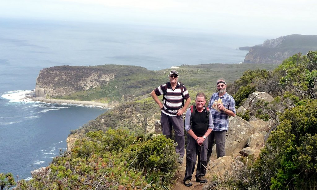
March 2016 - Three Capes Track

This brand new "icon walking trail" has only been open since December 2015, and Tasmania's Parks and Wildlife Service did an excellent job promoting it in the leadup.  Many of us locals pooh pooh the idea of gentrifying a walk that is already familiar to our keen bushwalkers, and others baulk at the entry price.  But this walk, with its well engineered tracks and carefully supported campsites, suddenly makes Cape Pillar accessible to those of us who are not up to the challenge of the long one day return walk from Fortescue Bay (posted as 10 hrs return) or the carry-all-gear two night camping trip option.  So tickets to the Three Capes Track became Di's Christmas present to Robert. 

When booking in December we had selected a free four day window in our early autumn calendar, and all of a sudden it was upon us.  There was a last minute scramble to unearth the long unused camping gear.  This is when we discovered we didn't know where one of our sleeping bags was and also we didn't have two backpacks of the right sort of size (they recommend 50L packs).  Some last minute repairs to packs and gear were required, and thanks to Sally and Jeff for the loan of a sleeping bag and cute camping pillows!

Our camping planning skills were a bit rusty.  In fact we worked out that our last camping trip had been an attempt on Cape Pillar in 2003, in the company of Andrew Windle and others.  That trip was thwarted by fires, which on arrival at Fortescue Bay we discovered had resulted in the closing of the Cape Pillar track.  Plan B was a walk north to Bivouac Bay, a nice little camp but it rained that night, and we beat a bedraggled retreat home the following day.  We were probably saved a wet and uncomfortable ordeal on Cape Pillar!

For our 2016 attempt we set out with the prospect of four days of excellent walking weather (so lucky!).  We had selected the first ferry to the start (11.30am, you can also choose a 2pm departure) and arrived at Port Arthur in good time.   Entry to the Three Capes Track experience includes a day pass to Port Arthur, so for many people it would be a good option to spend the morning sightseeing at Port Arthur and then catch the 2pm ferry.  Extra bonus - on checking in, we were given a Ticket of Leave, which gives you two years' free entry to Port Arthur - that was a nice surprise.

Cape Pillar track and camping options - Tasmap Cape Pillar map
 
We were met at the ferry by two of Rob Pennicott's well trained boat crew (Kane and Drew), and were treated to over an hour of enthusiastic introduction to the waters and wildlife of Port Arthur.  This gave us all some good context to the cliffs we would be walking on and looking over for the next four days, and also demonstrated the strong conservation ethic of the walk.  We sighted Cormorants, Gannets, a pair of nesting White Bellied Sea Eagles, and two types of albatross - Buller Albatross and the Yellow Nosed Albatross. 


We were neatly landed in pretty Denmans Cove, where most of us stopped for our first picnic lunch before setting out on the track.  As we started the walk it became clear that we were going to be treated to a curated experience, with quirky, thought provoking sculptures and seats dotted along along the trail.  The Three Capes Track handbook we had each been given proved to be a mine of interpretive information, and the rest spots served as clever hooks for questions and answers on what we were seeing. 


No gaiters required! The track has been carefully designed to provide sound footing and easy grades, and it is often possible for two to walk side by side.   A major driver for this is to keep walkers on the path, to avoid damage and risk of infection of the pristine bushland.  As the path is so good, you don't need to scrutinise the path for tree roots and potholes, you can just enjoy the view. The track is one-way, heading south at this point.


Day 1 is an easy 4km, and after about an hour we suddenly arrived at an amazing sight.  The first campsite, Surveyors, materialised from the bush more like a wilderness resort than a hut, with our host ranger waiting on the steps to meet us.

Arriving at Surveyors campsite

Sam welcomed us, explained how the site works and showed us to our rooms (four bunks to each).   The huts have been superbly designed by Hobart architects JAWS - stylish, modular, well made with quality materials, and completely contemporary.  They are equipped with modern kitchens, pots n pans, utensils, USB (only) charging, wide decks, communal hubs, small informative libraries and toilets. Note - no showers (except at Munro where you can try the cold shower).  Each campsite accommodates up to 48 walkers, in two hut modules.

Cabins for four
We had most of the afternoon free to relax, read, and introduce ourselves to some of our fellow hikers.   Cabin companions are kept constant throughout the walk, as the cohort of walkers moves on together, and we were pleased to be rooming with friendly and easygoing Mike and Linda, originally from Phoenix Arizona but who now spend their lives travelling. Over the four days....

Setting out on Day 2
Day 2 was an 11km walk to Munro camp, which took us 5 hours.   We took it easy, enjoying the views and the artworks along the way.  The birdlife was busy and loud but hard to spot in the dense bushes.

Overlooking Mt Brown, Crescent Beach, Cape Raoul
At three hours we found some rocks with a view, just right for our gourmet lunch of Tom on crackers, followed up with Nashi pears and scroggin.
 
Gourmet lunch on the track
At four hours, we got to the junction to Cape Pillar. Here the inbound track for walkers from Fortescue Bay also enters.  On the Saturday that our group of about 38 walked to the Cape, we only saw three non-paying walkers - two were doing the long day walk, and one was camping at Wughalee Falls.


Robert enjoying The High Life.


Arriving at Munro campsite
Munro is the busiest campsite of the track, and also the most striking.  It features a fabulous deck overlooking Munro Bight, offering perfect views towards Cape Raoul and Maria Island.  A steady sea breeze seems to blow up the cliffs onto the deck.  Once again, we had plenty of time to relax, chat, read, wash clothes.  Some people went off and did an extra loop walk around the site. Ranger Robin read us the riot act at the 6pm briefing on do's and don'ts which will ensure minimal impact on the pristine natural environment.


 Day 3 - the sunrise from the platform lookout over Munro Bight was fantastic.


Enjoying the sunrise, w Mike and Linda
We set off at a leisurely 9.20am!  As we were to pass back through Munro later that day, we left our backpacks here and set out with just a daypack, carrying water, lunch and a jacket.  It was a long day but a great experience, passing through a wide range of vegetation types, and we stopped for every view.   The sensitive heathlands are now well protected by kilometres of duckboard.
See the old track meandering below.


Hurricane Heath wasn't too windy that day, and (the now protected) Perdition Ponds were looking pretty dry.   Soon the path was edging along the clifftops, with spectacular views coming thick and fast.  There was time for a midday snack of nashi pears and scroggin.

Toward Cape Raoul.
  Tasman Island looked remote and romantic.
Tasman Island.
After a look at The Blade from the "Seal Spa" lookout, we climbed it - it was steep, exposed and a little scary:


But what a triumph to get to the top!


There are NZ and Australian Fur Seals on the rocks at the bottom of Tasman Island, and some were having a great time splashing around in a large rockpool.

Boots over The Blade
We celebrated by having lunch on The Blade, and lingered as long as we could before heading back at 1.30pm , ready to enjoy the track from a different perspective.
 
What is it, Bob?
At Munro we quickly repacked our backpacks, loaded up and set out for Retakunna, which we reached a bit over an hour later.  In total we were on the track for seven and a half hours that day, walking the 17 km, and were pretty buggered.

Retakunna was a pleasant relaxing camp.  Although it didn't have spectacular views, the surrounding trees were full of birds.

Day 4 - more than half the group left very early so that they would be in time to catch the 2pm shuttle from Fortescue Bay back to Port Arthur.  We were the last to leave (at 8.50am), taking it easy  and had time for a good chat with Ranger Donna-Lee.  She was very impressive, being outgoing, friendly and kind on top of having the mandatory custodian-type ranger's skills.

Chatting with Ranger Donna-Lee
 
Final pack
 
A good spot for evening bird watching

We walked up Mt Fortescue, a long climb through a delightful moist myrtle forest.  After an hour's walking we reached the top and we found we were in a cloud.  It even rained slightly. 

Cloud obscuring the view!
The track along the ridge toward Cape Raoul was fairly easy and offered more great views over the sea.  The Pillars of the South stop gave a great view of Mitre Island.  Our last gourmet lunch was on the clifftop, looking back to Cape Pillar, marvelling that we had walked all that way.


At the turnoff to Cape Hauy, Three Capes walkers once again drop their backpacks and do the Cape Hauy leg with daypacks.   When WE got to the turnoff to Cape Hauy at 12.45pm, it was an easy decision to confirm that we would skip it and head straight to Fortescue Bay.   We had already been to Cape Hauy on the upgraded track, in May 2012.

Note - there is no invitation to head to the right, as the Three Capes Track is one way only, northwards, on this stretch.

Walking from the Cape Hauy turnoff to Fortescue Bay we could see the slight deterioration in the track since 2012, and we realised how spoilt we had become in our first three days on the Three Capes Track!


Last breather.


The last word, at Fortescue Bay.
It was lovely to finish (hurrah!) at beautiful Fortescue Bay (2.15pm).  Sadly the end of trip facilities in the run-down carpark were a bit of a let-down, although that didn't bother those walkers who still had the energy to go for a swim.  The 4pm shuttle bus zoomed us back to Port Arthur to pick up our car and head home for that gorgeous hot shower.

The Three Capes Track was a great experience, and we thought the current four day/three night option was just right for us.  They will be starting construction on the Cape Raoul extension in a few months, so in a year or so it is likely that the only option available will be the full six day/five night experience.

Tips:
Only Telstra gives a reasonable phone reception in the area.  
Take a good book for extended reading pleasure in the quiet afternoons.

Details of the walk and facilities fees are here: www.threecapestrack.com.au.  If you are walking to Cape Pillar, by whatever route, I recommend getting the Cape Pillar walks map in advance.  You can get it as a digital download from Tasmaps, and probably also a hard copy from map sellers.

February 2016 - Mt Direction

George, Robert and Di were lucky with the weather for this walk, which we'd done last year in March.  We set out before 10am, it was generally overcast but mild (perfect walking weather!) for all of our walk up Mt Direction and back around the Risdon Dam, and it was just cooling down and starting to sprinkle as we got back to the carpark, which was a bit after 1.30pm.

We enjoyed our return visit to Mt Direction.  This time we didn't get lost on the way up, bonus!.  As per our last visit, there were lots of wallabies along the track.  This time we spotted a Flame Robin.  The uphill stretch was definitely mountain-like, with several rests required.

At the top George spotted a lovely wallaby with (we're sure) a joey in the pouch.


At the top:


And this time we followed the little cairns to a good lookout over Nyrstar and the river, where we enjoyed our snacks while resting our legs.


The gaiters were a bit OTT.

The view upriver - stunning:

Next time, take binoculars!   The return leg down the mountain was a bit punishing on the knees, but the circuit around the dam was a breeze by comparison and so it was good to finish the walk on a roll.

So, in total it was a nice 10km walk, we climbed up a total of 453m, and it took us about 3.5 hours overall.


January 2016 - Shipstern Bluff

This month Bob led a group on a walk to Shipstern Bluff.  The weather wasn't looking too good as they set out, but he could report on FB:

Ignored the weather forecast and walked to Shipstern Bluff today. So glad I did, the rain held off for most of the walk and I got a day in the bush with friends, and only a little bit wet!


October 2015 - Florentine River via the Timbs Track


After some late withdrawals, due to (thankfully minor) medical issues, this walk had three participants: Angie McGowan, George Plumb and Angie’s young neighbour Kailash Walker. Thanks Angie for this excellent story and pictures!

We took with us The Wilderness Society’s Self Drive Guide notes, downloaded from the TWS website: https://www.wilderness.org.au/upper-florentine-self-drive-guide. The drive from Hobart to the Timbs Track is about 2 hours. The walk to the Florentine River is a relaxed 2 hours one-way.

We met up at George’s place in Sandy Bay and set off at about 9am. The start of the Timbs track is about 21 km past Maydena, and the small car-park at the side of the road is clearly signposted.


After checking out the new interpretations sign we started walking at around 11am. The first part of the track, through lovely mixed forest, was slow-going with lots of fallen trees across the track. But after half an hour of clambering and diversions we got to more open country, which was much easier going, although there were a couple of very large puddles which we skirted around. We discovered at least two species of tadpoles in the puddles! 

About an hour from the track head, there is a wooden platform look-out a short distance to the right of the track. You can’t see the look-out from the track, but there is a small painted sign showing the way. From there we had great views of the surrounding mountains and across the forest to the Florentine.


About another half hour, mostly downhill, the Timbs Track meets the Old Adamsfield Track. Here we took the left turn westwards towards the Florentine River. The Adamsfield Track, which is wider and still has some old cording in places, goes through some lovely forest down to the River. A few metres before the River, there are two huts. The first, on the right hand side of the track, is the newly reconstructed Ewes Inn hut – which would be a very welcome shelter in inclement weather. The second hut, on the left hand side of the track, is in a ruinous condition.


With a couple of brief stops for snacks and to check out the wildlife (tadpoles and birds) and the views, we got to the Florentine River about 1pm, where we had our picnic lunch and refilled water bottles . We didn’t cross the River, but this would be possible by walking carefully over some large fallen logs. The old bridge across the river has long gone.


The walk back to the car park took about 1.75 hours, with fewer stops for snacking etc. On the way back along the Adamsfield Track we saw a tiger snake wriggling away from us. The forecast showers didn’t eventuate. And we got back to Hobart about 5.30pm.

September 2015 - Mt Misery

Caroline organised this walk to Mt Misery,  a 6km walk past Ranelagh near the Huon Bush retreats - an ascent of about 280 m on a good track  - about 3.5 hours in duration.

The walkers today were George, Lyn, Kat, Philip, James, Wayne, Gerwyn, Bob, Caroline and Warren.

The walk starts at the left of the picnic shelter at Huon Bush Retreats.  It leads through wet forest and rainforest, with large stands of personfern, to a sandstone plateau, clothed in heath, that allows views to the southwest wilderness.  Crossing the plateau and a saddle you will reach a rocky outcrop with a miserable face!  Retrace your steps for much of the way, enjoying the different view you see facing downhill, and finish with a visit to a live tree gutted by fire, and a small waterfall.

Thanks to Kat and Warren for the photos.


The grade is Medium, and the total walk is 6.3km, talking about 3 hours and 30 minutes.  Further information can be obtained at www.huonbushretreats.com.


September 2015 - Apsley Gorge

Robert and Di did this walk while enjoying a weekend escape on the East Coast with Wanda.

We thought we'd take a little look at the Apsley River end of the Douglas-Apsley National Park, having not been there before.  This is one of Tassie's Parks and Wildlife Service's Great Short Walks, so some details can be found here.  PWS suggest doing the walk over the hill and returning along the same path (2-3 hour return, 5.6km return).  We used the walk description in "Day Walks Tasmania" by John and Monica Chapman - they suggest doing the full loop  i.e. returning along the river bed.

With thanks to "Day Walks Tasmania"
Go 4.5km north of Bicheno, turn left onto Rosedale Road (well signposted), then enjoy 7.5km winding through pleasant farmlands (mostly unsealed), and find the roomy carpark.  After signing into the walkers' log there is an option of a short 5 min loop walk to the Lookout over the Apsley River - but NOTE the Lookout is currently closed off for repair.

It is a few minutes' walk down to the Apsley River, which is very pretty, and home to the Australian Grayling (they ask you not to wear sunscreen if you are going for a swim, as it is harmful to the fish).  Here you can swim, picnic, and rockhop across to the other side where the Apsley Gorge walk commences (and the longer Leeaberra Walk comes in from the north).

We set off northwestwards from the river at 11am, thinking of just doing a short walk as we hadn't packed a lunch or much in the way of gear. This is a comfortable uphill climb, with lots of nicely made stone steps where required.  We spotted a hooded orchid at the side of the path and later on met a chap taking lots of photos of orchids (he'd found a spider orchid).

There are no lookouts along the path,  which rises to a long ridge and passes through attractive typical East Coast dry forest.  The track was dry and conditions were perfect on this spring day.  Lots of spring flowers were out.
Comesperma volubile (Blue Love Creeper)


Banksia marginata


When we reached the end of the ridge, we made the snap decision to keep going and do the full loop walk.

There had been plenty of warnings about precautions for people choosing to walk back along the river, such as the Chapmans'  "The walk through the gorge requires scrambling over rocks and sturdy footwear is recommended.  There is no track through the gorge and it should not be attempted after heavy rainfall".   PWS had alarming signs posted showing people falling off rocks and a note that there is no mobile signal in the Gorge.  Duly warned, we decided to give it a go.  We were wearing sturdy shoes but not boots, which would have made it easier, but it was a beautiful day, so what the heck.

At about midday we reached the river upstream in the Gorge.  It is a beautiful spot.

Once again, a great spot for picknicking and swimming, more pristine and a lot more private than at the beginning of the walk.


The Chapmans measured the loop as 6.1km.  My recording via Strava showed 8.4km to and from the carpark!  I believe Strava.

It took us about 3 hours to rockhop our way down the riverbed back to the walk's start, and it used every muscle in our bodies. There is no marked track, you have to continually judge the best (only?) way forward, having to cross the river again and again to make progress.  It was rugged, pristine and beautiful.   The rocks ranged from huge boulders to sheer cliff faces to stretches of river gravel, and occasionally some minor bushbashing was required to navigate our way without getting our feet wet (or worse).


Slipping and falling could have been quite serious, and prospects of getting help in a hurry were pretty slim, so our minds were focussed!  Di had emergency muesli bars packed (Be Prepared!), so we were able to stop for a snack and let our legs recover a little.  It seemed to take forever (we had missed lunch, after all) to rockhop down the many bends, admiring the spouting waterfalls and clear but cold pools.

At about 3pm we made it back to the beginning, exhausted but smug. So the total walk time was 4 hours.  Notes for next time:  do take lunch and have a good picnic on the beautiful river rocks; be well prepared with rockhopping footwear and contingencies for accidents (such as a Personal Location Beacon PLB);  and make sure the river is not high.